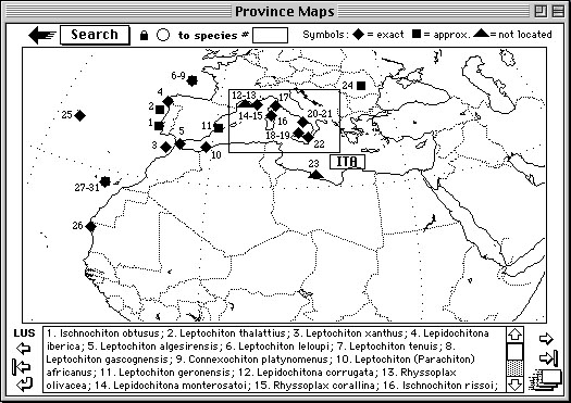
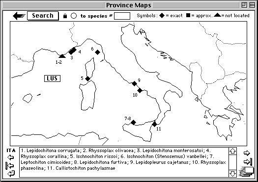

Example cards from "Province Maps" stack, depicting the two maps displayed
(in this case) when the
Lepidopleurus cajetanus "Province" button was clicked on its
Species card. These maps are modified
during species entry or removal, and can be periodically updated to
semi-automatically renumber the species
buttons from left to right on the card. Current marine biogeographic
provinces are based on the only
worldwide system proposed to date to my knowledge (Briggs, 1974). When
the provided maps have
become locally crowded, I have added expanded views of those regions
(e.g., the second "ITA" map
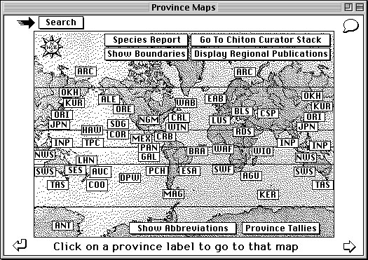
above). The arrow button in the upper-left corner navigates to the
main Province Maps page, which
has a schematic map with buttons corresponding to all available province
maps (below). A higher-resolution
map (colored according to polar/cold-temperate/warm-temperate/tropical
distinctions) is shown by
clicking on the "Show Boundaries" button. Another map with (outdated)
links to regional publications
is also available. The "Province Tallies"
button allows for the interactive display of distributional patterns
by species- or higher-level taxa, as partly describe for the "Range
Maps" stack.
Return to Chiton Card Page
Return to Worldwide Chitons Home Page
This Web page and its contents © D. J. Eernisse, 2001. Created 6/5/01, last modified 6/5/01.